Back to WATER INSIGHTS

.jpg)
By Tyne Eckmyn, Publishing Associate: Researcher and Writer at Save the Water™ | July 26, 2026
Edited by Joshua Awolaye, Publishing Associate: Editor at Save the Water™
Just north of the Grand Canyon, lies the Kaibab Plateau. Each spring, as the snow covering this high plateau begins to melt, it disappears beneath the ground. It makes its way through an enormous cave network, and re-emerges into the Grand Canyon at Roaring Springs. This cave network brings the water to the humans, plants, and animals of the Grand Canyon. But it can also bring contaminants and disease. A new research project from Northern Arizona University is working to map this labyrinthine cave network. The aim is to better understand how water and pollutants flow through the Grand Canyon’s cave system and similar systems worldwide.
The speed at which water travels underground varies enormously. It depends on the composition and structure of the ground it is travelling through. The water from the Kaibab Plateau primarily travels to the Grand Canyon through a landscape and cave system known as karst. This type of cave network forms when groundwater dissolves bedrock, forming sinkholes, caves and springs. Sedimentary rocks like limestone underlie the Kaibab Plateau and form the Grand Canyon’s walls. Limestone is especially prone to forming karst systems. The fractures, cavities, and open channels of these systems can allow groundwater to move quickly and unpredictably through the subsurface.

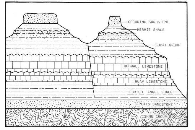
Dye tracer tests have previously helped researchers understand some of the groundwater dynamics north of the Grand Canyon. These tests work by injecting fluorescent dyes into sinkholes, and then observing where and when they emerge from springs. This still leaves everything that happens within the caves themselves, completely opaque. To truly understand the complexities of the cave network, researchers needed to get inside.
Over the course of 45 days, researchers and volunteers documented over 10 kilometers of caves. They did this by hiking, rappelling, kayaking and swimming through them. Using mobile lidar sensors (MLS), researchers were also able to create detailed 3D models of the cave system.
This research is, of course, relevant to the preservation and protection of the Grand Canyon's water supply. Contaminants such as E. coli, or fallout from wildfires, can enter the cave network. They can then travel quickly and unpredictably through it to the Grand Canyon. The American Southwest region as a whole is also facing changing snowpack and water supply conditions. This makes research into the transport and storage of water in karst aquifers increasingly important. Around the world, millions of people and countless ecosystems rely on water stored and carried by karst cave networks.






Save the Water™ is a 501 (c)(3) non-profit organization with a mission to conduct research to identify and remove harmful contaminants in water and to raise public awareness about water contamination and its health impacts.